- 12741 Research Blvd. Suite 500 Austin, TX
- sales@rastracmarinevision.com
- (877) 680-1188
A pontoon boat disappears from a marina overnight. A fishing boat drifts outside authorized boundaries. A jet ski rental fleet requires constant visual monitoring. These scenarios cost the marine industry over $300 million annually – and traditional security methods can’t keep pace.
Standard dock locks and security cameras have limitations. Locks get cut. Cameras record theft but rarely prevent it. Recovery becomes a statistical nightmare: only 10-30% of stolen boats without GPS tracking are ever recovered. Meanwhile, charter operators struggle with fuel costs, rental companies deal with boundary violations, and marina managers face liability concerns when watercraft leave authorized areas undetected.
GPS tracking with real-time alerts changes this equation. Modern marine monitoring systems deliver instant notifications when a speedboat starts unexpectedly, when a sailboat crosses geofence boundaries, or when a bass boat operates outside business hours. This isn’t passive security – it’s active asset protection that responds the moment risk appears.
Geofencing: Your First Line of Defense
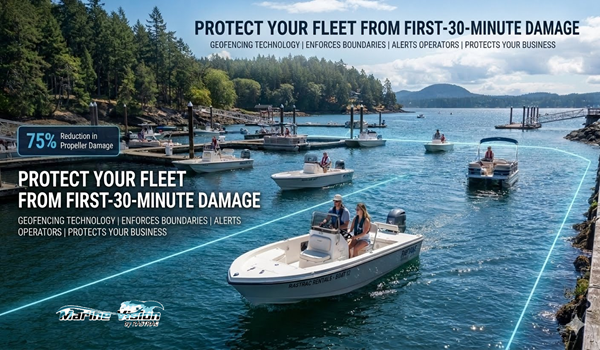
Geofencing creates virtual boundaries around marinas, rental zones, or dangerous areas. When a center console crosses these boundaries, you receive immediate text or email notifications. Marine Vision by Rastrac supports three geofence types: polygon fences with up to 500 boundary points for irregular coastlines, circular fences for simple coverage areas, and corridor fences that follow specific routes.
A documented case study showed 75% reduction in propeller damage during the first season after implementing geofencing alerts. How? Operators defined shallow water zones and no-wake areas as restricted geofences. When a wakeboard boat approached these zones, the system alerted both the operator and the driver. This prevented costly propeller strikes against underwater hazards.
Rental operations see 40-60% reduction in damage claims using geofence enforcement. Set boundaries for rental areas, receive instant alerts when a deck boat ventures too far, and respond before minor boundary violations become major insurance claims. Insurance providers recognize this value – active GPS tracking qualifies for 5-15% premium discounts.
Multi-Layer Alert System
Real-time monitoring extends beyond geographic boundaries. Modern marine GPS platforms track multiple risk factors simultaneously:
Operational Alerts
Maintenance Alerts
Security Alerts
Each alert routes to designated personnel via text, email, or mobile app notification. Response times matter – GPS-tracked boats have 80%+ recovery rates because owners know within minutes that theft occurred and can provide law enforcement with real-time location data.
Precision You Can Trust
Marine GPS tracking delivers location accuracy within 10 feet for most applications. This precision enables verification of specific dock assignments, confirmation that a yacht reached an exact waypoint, and documentation of where a fishing boat operated throughout the day.
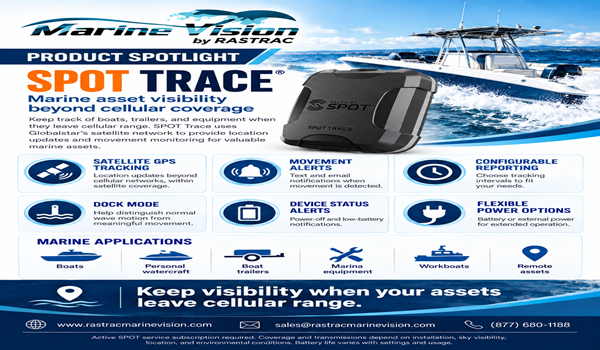
Marine Vision provides cellular GPS tracking ideal for coastal operations and hybrid satellite/LTE tracking for offshore applications. The ST4215 device handles near-shore environments with cellular connectivity, while the ST9100 automatically switches to satellite communication beyond cellular range. Offshore charter operators maintain visibility regardless of how far a speedboat travels from shore.
Fleet Intelligence Dashboard
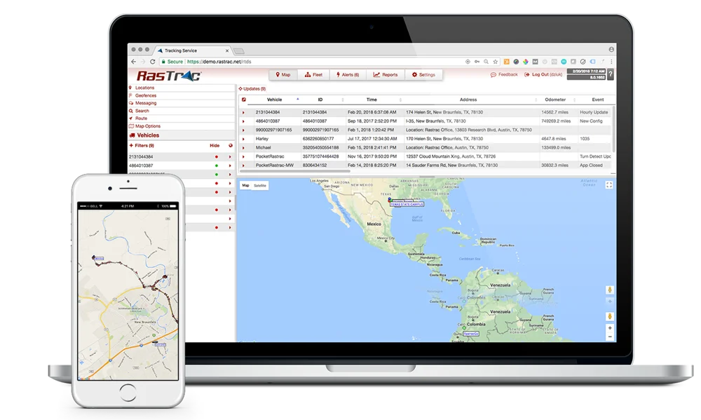
Marina operators and rental companies manage dozens of watercraft simultaneously. Manual visual checks become impossible beyond a handful of boats. Advanced GPS platforms consolidate fleet data into a single dashboard showing:
This reduces manual monitoring by approximately 80%. Instead of physically checking 50 jet skis to verify they’re all present and accounted for, glance at your dashboard. Any missing watercraft triggers an immediate alert.
Operational Optimization
Charter and tour operators save 15-25% on fuel costs through route optimization and idle monitoring. Historical tracking data reveals inefficient routes, excessive idle time, and opportunities to consolidate trips. A sailboat charter company might discover that certain routes consistently encounter headwinds – historical speed and direction data enables route adjustments that save time and fuel.
Engine hour tracking enables precise maintenance scheduling. Service intervals based on actual usage prevent both premature maintenance (wasting money) and delayed maintenance (causing breakdowns). When a pontoon boat reaches its 100-hour service interval, automatic alerts ensure timely maintenance that extends equipment life.
Hardware Built for Marine Environments
Marine GPS devices face harsh conditions: saltwater spray, humidity, temperature extremes, and constant vibration. Water-resistant and weatherproof designs prevent corrosion and water intrusion. Compact form factors fit smaller watercraft without consuming valuable space.
Installation requirements matter. Battery-powered options work for boats without accessible power systems – solar-powered trackers like the BeSol offer continuous recharging without battery replacement. Hardwired installations provide constant power for boats with accessible electrical systems, enabling features like remote alarm activation for at-risk watercraft.
Platform Reliability and Support
A GPS tracking system only protects assets when it’s actually working. Marine Vision by Rastrac maintains 99.99% platform uptime across 32 years of operations, currently tracking over $2.5 billion in assets worldwide. This reliability means alerts reach you when they matter most.
Real human support eliminates chatbot frustration. When you call with a question about geofence configuration or device installation, actual GPS tracking experts answer – no automated systems, no offshore call centers. This matters during emergencies when every minute counts.
Integration and Flexibility
Modern operations require GPS data in multiple systems. API integration enables custom dashboards, ERP system connections, and dispatch software compatibility. Third-party device support means you’re not locked to proprietary hardware – use platform-recommended devices or integrate compatible equipment you already own.
White-label and private-label solutions serve dealers and resellers who want branded marine tracking platforms. The technology provider handles server infrastructure and maintenance while partners focus on customer relationships.
Getting Started
Most marine GPS installations take minutes, not hours. Battery-powered devices require no wiring – mount the tracker, activate the service, and start monitoring. Hardwired installations involve straightforward connections to the boat’s power system.
Configuration happens through web-based interfaces accessible from any internet-connected device. Define your geofences, set speed limits, establish maintenance schedules, and configure alert recipients. Mobile apps for iOS and Android enable monitoring from smartphones and tablets.
Training and Onboarding
Comprehensive training ensures you extract maximum value from your marine GPS system. Video tutorials, user guides, and phone support help new users master the platform. Most basic functions become intuitive after 15-20 minutes of exploration.
Advanced features like corridor geofencing, custom reports, and API integration may require additional training, but core security functions – location tracking, geofence alerts, and theft notification – work immediately.
Ongoing Support
Questions arise. Needs change. Reliable support keeps your security system effective. Look for providers offering phone support, comprehensive online knowledge bases, and direct access to technical experts. Some platforms provide dedicated account managers for larger fleets.
Making the Investment Decision
Total Cost of Ownership
Marine GPS security involves device costs and monthly service fees. Hardware costs vary by feature set – basic cellular trackers cost less than hybrid satellite/LTE devices. Monthly fees typically range from $15-40 per watercraft depending on features and contract length.
Compare this to potential losses. A single stolen jet ski represents $10,000-15,000 in unrecovered assets. One insurance claim from unauthorized use might exceed $5,000. The documented 75% propeller damage reduction alone can justify the investment for rental fleets within a single season.
Insurance premium reductions of 5-15% may offset monthly service fees entirely. A yacht with $3,000 annual premiums saves $150-450 per year with active GPS tracking – potentially covering the cost of the service.
Marine Vision Fleet ROI Calculator
Contract Flexibility
Avoid long-term commitments that lock you into outdated technology. Month-to-month contracts or short annual terms provide flexibility as your needs evolve. Some providers bundle hardware costs into monthly payments, eliminating upfront device purchases.
Verify that devices aren’t locked to a single software platform. Hardware-agnostic systems let you switch providers without replacing expensive tracking equipment. This protects your investment if you later need different features or find better pricing.
The Competitive Advantage
Marine businesses face intense competition. Rental companies differentiate with better safety records. Charter operators attract customers with documented reliability. Marina operators reduce insurance costs and liability through proven security measures.
GPS tracking with real-time alerts provides measurable advantages:
For Rental Operations: 40-60% damage claim reduction, boundary enforcement, theft deterrence, insurance savings, and automated fleet monitoring.
For Charter Businesses: 15-25% fuel savings, route optimization, maintenance tracking, safety zone enforcement, and customer communication improvements.
For Marina Operators: Reduced liability, theft prevention, and regulatory compliance documentation.
For Individual Owners: 80%+ theft recovery rates, insurance premium reductions, remote monitoring from anywhere, and peace of mind knowing your investment is protected.
The marine industry loses $300 million annually to theft. Recovery rates without GPS tracking remain stuck at 10-30%. These statistics represent boats that disappear and never return, insurance claims that spike premiums, and owners who lose their watercraft permanently.
Real-time GPS alerts change these outcomes. When a bass boat starts unexpectedly at 2 AM, you know immediately. When a pontoon boat crosses a geofence boundary, alerts reach your phone in seconds. When a fishing boat moves without authorization, you have real-time location data to provide law enforcement.
This isn’t theoretical protection – it’s documented risk reduction backed by 32 years of industry experience and $2.5 billion in assets under management. The 75% propeller damage reduction came from real operations. The 80%+ recovery rate reflects actual theft responses. The 40-60% damage claim reduction represents measured rental fleet improvements.
Modern marine GPS tracking eliminates the monitoring burden while strengthening asset protection. Automated alerts replace constant visual checks. Real-time data replaces guesswork. Documented compliance replaces hope.
How quickly do alerts reach me after a trigger event?
Most platforms deliver alerts within 10-60 seconds of trigger events like geofence violations or ignition activation. Speed depends on device reporting intervals (configurable from 10 seconds to several minutes) and cellular network latency. Critical security alerts typically use high-frequency reporting to minimize delay. Text messages usually arrive faster than emails.
What happens if my boat goes beyond cellular coverage?
Hybrid satellite/LTE devices like the ST9100 automatically switch to satellite communication when cellular towers become unavailable. These devices cost more than cellular-only trackers but provide continuous coverage regardless of distance from shore. Coastal operations within 10-20 miles of land typically maintain reliable cellular connectivity and can use less expensive cellular-only devices.
Can I track multiple watercraft types from one dashboard?
Yes. Professional marine GPS platforms support mixed fleets including jet skis, fishing boats, sailboats, pontoon boats, and larger yachts from a single interface. Create groups to organize different watercraft types, assign custom icons for visual identification, and configure alerts specific to each boat’s operational parameters. Rental companies often manage 50+ diverse watercraft from one dashboard.
Do GPS trackers work on boats stored on trailers?
Absolutely. Battery-powered and solar-powered GPS devices work effectively on trailered boats. The ST4215 cellular tracker and BeSol solar-powered tracker both function whether the boat is in water, on a trailer at home, or stored at a facility. Some owners specifically use GPS tracking to monitor boats during offseason storage when theft risk increases.
How does GPS tracking affect my insurance premiums?
Most marine insurance providers offer 5-15% premium discounts for boats with active GPS tracking systems. Some insurers require documentation showing the tracker is functional and monitored. Contact your insurance provider for specific discount eligibility – savings often cover a significant portion of monthly GPS service fees. Rastrac has documented cases where insurance discounts exceeded the cost of the tracking service.
Thirty-two years of GPS tracking experience. Over $2.5 billion in assets protected worldwide. A 99.99% uptime record that ensures your alerts reach you when they matter most.
Marine Vision by Rastrac Marine Vision delivers the comprehensive monitoring, real-time alerts, and documented risk reduction that modern watercraft operations demand. Whether you’re protecting a single bass boat or managing a 50-unit jet ski rental fleet, the platform scales to meet your needs without requiring infrastructure investment or long-term commitments.
Stop accepting outdated security methods that can’t prevent theft, can’t enforce boundaries, and can’t reduce the $300 million annual cost of marine theft. Start leveraging GPS technology that delivers 80%+ recovery rates, 75% damage reduction, and 5-15% insurance savings.
Request a Demo | (877) 680-1188 | sales@rastracmarinevision.com

Rastrac complements any organization-wide quality assurance program and can help their fleet become the model for operational superiority.
Rastrac helps clients make improvements in processes, organization, financials, communications, and technology. Clients that have taken advantage of Rastrac’s ability to provide solutions tailored to their business are in a wide variety of industries. Rastrac can help you find a solution, too.
We’d love to discuss how we can help you.
Basic service for your OEM-connected vehicles. No hardware. No installation.
Offer ends November 30, 2026
