- 12741 Research Blvd. Suite 500 Austin, TX
- sales@rastracmarinevision.com
- (877) 680-1188
You’re a rental operator managing a fleet of pontoon boats when a renter reports damage to the propeller. They claim they hit a submerged object, not rocks near the shoreline. Without geofenced data showing exactly where the watercraft was at impact, the claim stalls for weeks.
A center console operator experiences a mechanical failure mid-trip. The manufacturer says maintenance was overdue. You argue the engine hours log shows otherwise. Without telematics data with timestamps, it’s your word against theirs.
Evidence matters in the watercraft industry. GPS tracking, geofencing, and onboard telemetry aren’t luxuries – they’re the difference between resolving claims in days and fighting them in court for months. Rastrac Marine Vision combines real-time location tracking, water-resistant telematics hardware, and automated alerts to give watercraft operators and rental companies an irrefutable record of every trip, every zone violation, and every moment of operation.
This guide covers the monitoring systems that actually hold up under scrutiny: location precision, geofencing documentation, and the telematics evidence that settles disputes.
When an incident occurs on water, location is everything. Was the watercraft in a shallow area where propeller strikes are common, or in open water where damage implies operator error? Did the ski boat enter a restricted zone marked by geofence, or stay in the designated rental area?
Traditional incident reports rely on operator testimony. Rastrac Marine Vision logs GPS coordinates with accuracy within 10 feet for marine applications, timestamped to the second. This creates objective, court-defensible proof of where the watercraft was at the exact moment an incident occurred.
GPS position reports at 10-30 second intervals create a “breadcrumb trail” of the watercraft’s exact path before, during, and after an incident. Insurance investigators can see:
This reconstructs the narrative without relying on a renter’s after-the-fact memory or contested claims.
When you establish geofences around rental boundaries, no-trespass zones, or dangerous current areas, every entry and exit is recorded with timestamp and operator. Consider the outcomes:
Beyond location, onboard telematics create an irrefutable operational log. Engine hours, battery voltage, speed, RPM, and maintenance intervals – all timestamped and immutable – eliminate “he said, she said” disputes.
Manufacturer claims the engine required service at 500 hours of operation. You claim the watercraft only reached 450 hours. Without telematics, this devolves to document scrutiny. Rastrac Marine Vision logs engine hours continuously, synced to GPS time:
The watercraft’s speedometer may be inaccurate or inoperative. The telematics system logs speed continuously via GPS and vessel electronics. When an incident occurs:
Battery voltage monitoring catches early electrical system failures that can strand renters or cause starting failures. When a battery dies mid-rental:
An incident occurs, but nobody notifies you for 3 hours. By then, evidence is fragmented – the renter may have moved the watercraft, other boats have disturbed the incident scene, and operator memory is already fading.
Rastrac Marine Vision’s automated alert system triggers immediately:
Alert-Triggered Evidence Capture:
When a geofence breach, speeding incident, movement alert, or battery issue fires, the system captures a complete snapshot:
This snapshot is timestamped, immutable, and available to you within seconds. No waiting for post-trip analysis – evidence is secured in real-time.
Geofence Breach Alert Example:
A renter takes a personal watercraft into a “No Entry – Current Hazard” zone:
If the renter injures themselves in the hazardous zone, you have proof that they were in a restricted area with known hazards, and the exact timestamp of when they entered it.
Speeding Alert Example:
A wakeboard boat exceeds safe speeds in a congested anchorage:
Documentation Points:
Rastrac Marine Vision uses water-resistant hardware purpose-built for harsh marine environments:
ST4215 – Water-Resistant Tracker:
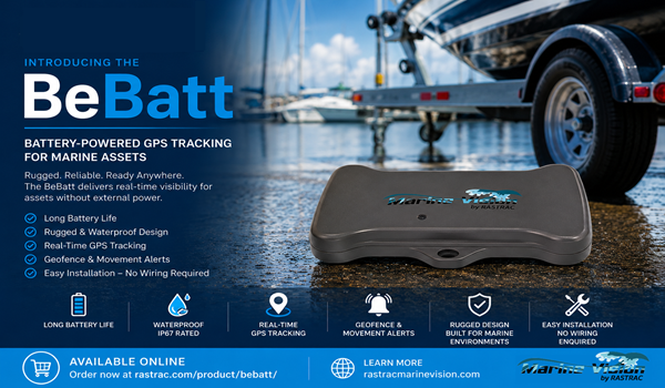
Compact, IP67 (dustproof and waterproof) device ideal for smaller watercraft and coastal operations. Requires minimal installation, pairs with GPS location and telematics connectivity without specialized wiring. Survives saltwater spray, humidity, temperature extremes from -20°C to +60°C.
ST9100 – Hybrid LTE/Satellite Device:
For offshore operations beyond cellular coverage, the ST9100 switches automatically between LTE and satellite communication, ensuring evidence capture even in remote waters. Ideal for charter boats, offshore fishing, and open-ocean operations where cellular signal is unreliable.
Both devices store telematics data locally and sync to the cloud when connectivity is restored, ensuring no loss of critical evidence even during temporary communication lapses.
Q: Is GPS location data admissible in insurance claims and legal proceedings?
A: Yes. GPS location data is objective, automatically generated, and timestamped – it’s considered highly credible evidence. Geofence breach records and breadcrumb trails have been successfully used in accident reconstructions, liability disputes, and rental damage claims. However, consult your insurance carrier and legal counsel about specific evidentiary standards in your jurisdiction.
Q: What if a watercraft is stolen or involved in a hit-and-run?
A: Real-time GPS tracking becomes a recovery tool. The breadcrumb trail shows exactly where the watercraft was taken, the path it traveled, and its current location. This data can be provided immediately to law enforcement for recovery operations, reducing downtime and loss. Rastrac’s speed logs also prove whether the watercraft was operated at dangerous speeds during theft.
Q: How long does Rastrac retain telematics and location data?
A: Active data (position, telematics, events) is accessible for 90 days in the live system. Archived data can be recovered upon request from Rastrac support. For incident evidence, critical data should be exported and backed up immediately upon capture to preserve it for legal proceedings.
Q: Does the monitoring system protect me from liability if the renter ignores a geofence warning and gets injured?
A: The geofence alert and notification create evidence that the renter was warned of the hazard and proceeded anyway – this shifts liability toward operator negligence. However, liability protection depends on rental agreements, warning clarity, and local law. Consult legal counsel to ensure your rental agreement explicitly references geofence warnings and hazard acknowledgment.
Q: Can a renter dispute the GPS and speed data from Rastrac?
A: Disputing timestamped, automatically generated GPS location and speed data is extremely difficult. These readings are objective, synchronized to atomic clock time, and generated independently of operator input. Combined with geofence records and engine telemetry, they form a comprehensive, multi-source evidence package that’s nearly impossible to refute in court.
Watercraft operators and rental companies face unique evidence challenges: incidents occur on open water without witnesses, damage claims are often contested, and operator behavior is difficult to verify after-the-fact. Real-time GPS tracking, geofencing documentation, and continuous telematics data transform watercraft management from reactive to proactive – and from disputable to indisputable.
Rastrac Marine Vision’s combination of water-resistant telematics hardware (ST4215, ST9100), geofencing capabilities, and cloud-based evidence archival ensures that every incident is documented, timestamped, and defensible. The propeller damage reduction case study speaks to the broader impact: when operators know they’re being monitored, behavior improves. When incidents occur, evidence resolves them in days, not months.
Evidence collection and incident reporting aren’t afterthoughts – they’re core to watercraft fleet profitability and operator safety.
Related Content: GPS Tracking is helping marinas and boat rental businesses across the country thrive
Rastrac complements any organization-wide quality assurance program and can help their fleet become the model for operational superiority.
Rastrac helps clients make improvements in processes, organization, financials, communications, and technology. Clients that have taken advantage of Rastrac’s ability to provide solutions tailored to their business are in a wide variety of industries. Rastrac can help you find a solution, too.
We’d love to discuss how we can help you.
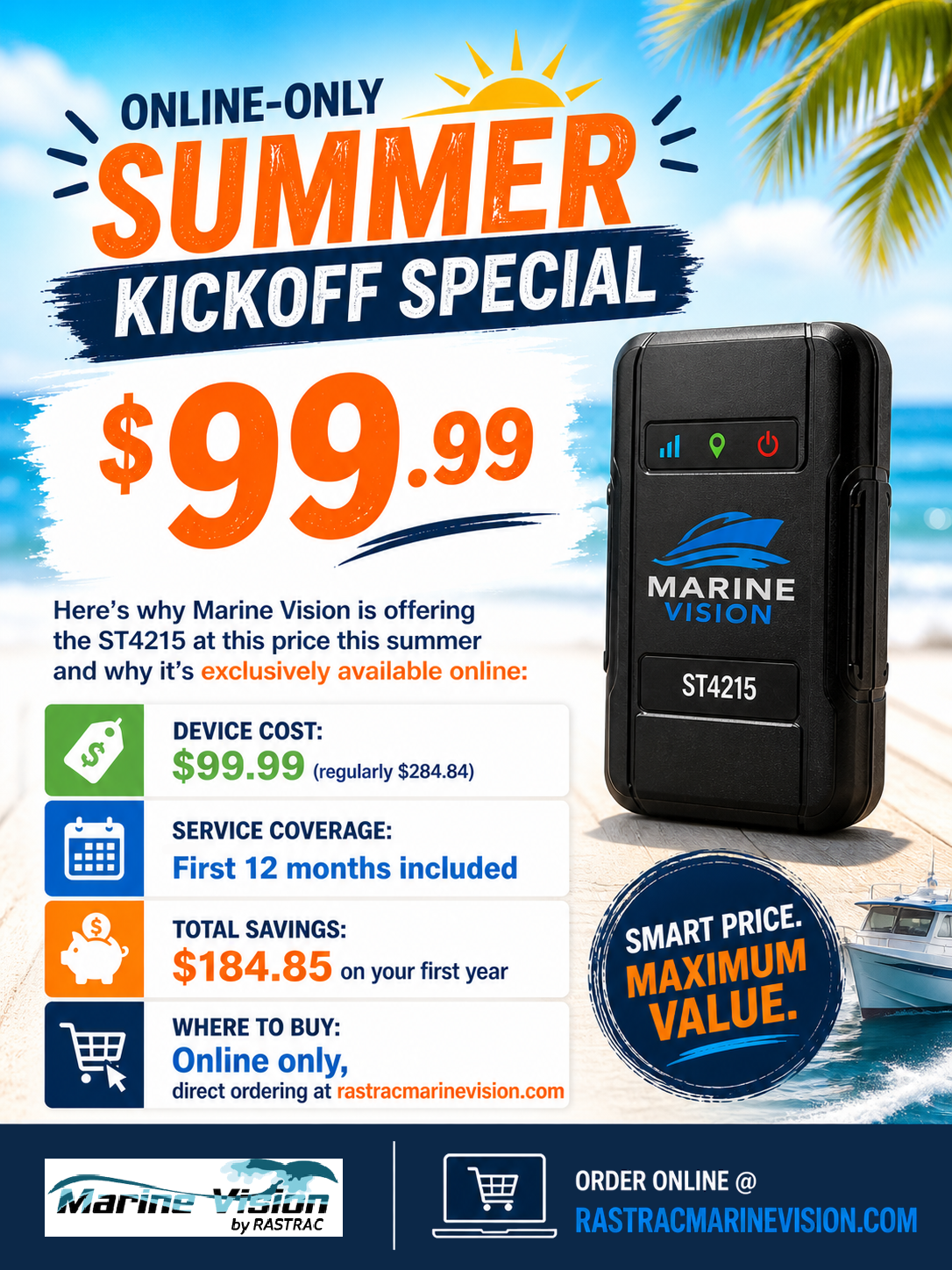
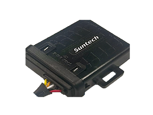
Track your boats, watercraft, and vehicles for less than $100/year.
ST4215 +1 year of Rastrac service, available for a limited time.
