- 12741 Research Blvd. Suite 500 Austin, TX
- sales@rastracmarinevision.com
- (877) 680-1188
Commercial marine operators face an impossible balancing act. On one side, growing tourism demands more jet skis, pontoon boats, and tour catamarans on the water. On the other, environmental regulations protecting manatee zones, seagrass beds, and coral reefs grow stricter every season. A single pontoon boat captain who misses a faded no-wake buoy can trigger thousands in government fines, lawsuits from conservation groups, and permanent damage to your company’s reputation. Traditional boundary management: physical buoys, channel markers, and printed maps, fails because storms shift markers, captains get distracted, and enforcement relies on after-the-fact investigations. Rastrac Marine Vision replaces reactive compliance with proactive protection through virtual eco-geofencing technology that keeps your commercial fleet operating legally while safeguarding the ecosystems that sustain your business.
Eco-geofencing creates invisible digital boundaries around environmentally sensitive waters. Unlike physical buoys that degrade or disappear, these virtual perimeters remain permanently fixed to GPS coordinates. When a tracked watercraft crosses a geofenced boundary, the system instantly triggers customizable alerts to fleet managers, dispatchers, or the captain directly.
Marine sanctuaries don’t follow neat geometric patterns. A manatee protection zone might snake along an irregular coastline. A coral reef boundary could wrap around underwater formations invisible from the surface. A seagrass restoration area might feature multiple excluded sections with narrow commercial channels threading between them. Generic circular geofences can’t accommodate these complex shapes; they either miss critical protected areas or trigger false alarms when boats legally navigate adjacent waters.
Rastrac Marine Vision solves this through advanced polygon geofencing with up to 500 customizable boundary points. Fleet managers can trace exact sanctuary borders on satellite imagery, creating digital fences that mirror real-world conservation zones perfectly. This precision eliminates the ambiguity that leads to accidental violations and ensures legitimate commercial routes remain clear.
The technology also addresses the reality that entering protected areas isn’t always illegal, speed determines legality. Many marine sanctuaries allow passage at strict no-wake speeds (typically under 5 knots) while prohibiting faster transit. Traditional all-or-nothing geofencing can’t distinguish between a compliant fishing boat idling through at 4 knots and a speedboat illegally racing through at 25 knots.
Creating effective eco-geofences begins with accurate boundary definition. Rastrac Marine Vision’s interface allows operators to overlay geofences directly onto Google Maps or satellite imagery. Fleet managers zoom into the target conservation area, then click multiple points along the sanctuary’s actual border. Each click adds a boundary vertex, allowing the digital fence to follow jagged coastlines, wrap around island chains, or exclude specific commercial channels from the restricted zone.
The platform supports geofences with hundreds of individual points. For a complex estuary system with multiple protected coves and legal navigation channels, operators can draw a single comprehensive boundary that accounts for every twist and inlet. This eliminates the need for multiple overlapping circular fences that create gaps or redundancies.
Once created, these digital boundaries sync automatically to every GPS tracker in your fleet. A jet ski rental operation monitoring 40 personal watercraft doesn’t need to program each unit individually, the central platform pushes the updated sanctuary map to all hardware simultaneously. When environmental agencies expand protected zones or create seasonal restrictions, updating the digital boundary takes minutes instead of the days or weeks required to deploy physical marker buoys.
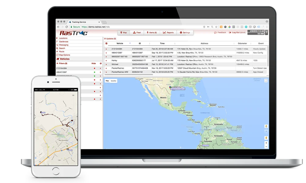
The visual confirmation feature proves invaluable during initial setup. Managers can view geofenced areas on the same map displaying real-time watercraft positions. This allows immediate verification that boundaries align correctly with known landmarks, channel markers, and sanctuary signage before enforcement begins.
The most sophisticated aspect of eco-geofencing involves layered conditional alerts. Rastrac Marine Vision allows fleet managers to create location-specific speed rules. A typical configuration looks like this: “Alert me only if a watercraft inside the manatee zone exceeds 5 knots.” The system remains silent when boats transit legally at no-wake speeds but triggers immediately when a captain accelerates beyond the threshold.
This conditional logic prevents alert fatigue. Without speed layering, managers receive notifications every time any watercraft enters the protected area, even when operating legally. A tour catamaran company running 15 daily trips through a regulated channel would generate hundreds of meaningless alerts. Speed-triggered monitoring sends notifications only for actual violations, allowing managers to focus on genuine compliance issues.
Rental operations reduce damage claims by 40-60% using geofencing enforcement, according to documented Rastrac case studies. This reduction comes from two factors: prevention and deterrence. Real-time alerts allow immediate radio contact with captains who unknowingly drift into restricted areas. The captain corrects course before wildlife authorities observe the violation or before propeller damage occurs in shallow seagrass. Additionally, rental customers who know their speedboat carries active tracking modify their behavior – visible GPS hardware deters intentional rule-breaking just as visibly as security cameras reduce retail theft.
The system also accommodates seasonal variations. Many marine sanctuaries implement stricter restrictions during breeding seasons or migration periods. Fleet managers can schedule geofence activation dates, automatically enabling tighter speed limits during sensitive months without manual intervention.
When environmental incidents occur – propeller scars across seagrass beds, wildlife strikes, or reported violations – commercial operators face immediate scrutiny. Local environmental agencies, conservation groups, and law enforcement may accuse specific watercraft based on witness descriptions, general operating areas, or simply proximity to the incident location. Without objective evidence, proving innocence becomes nearly impossible.
Rastrac Marine Vision provides comprehensive historical breadcrumb tracking. Every GPS tracker records position, speed, and time data continuously, creating a detailed movement history stored in the cloud. When authorities investigate an environmental violation, fleet managers can generate timestamped reports showing exactly where each watercraft traveled during the incident timeframe.
The data precision matters significantly. Marine GPS tracking achieves accuracy within 10 feet, making position records more reliable than eyewitness accounts or estimated timestamps. If an agency claims your commercial fishing boat damaged a reef at 2:45 PM on Saturday, the historical track data can definitively prove the boat was three miles away at that exact time or show it passed through the area legally at 3 knots with no sudden stops indicating grounding.
This documentation protects commercial operating licenses, insurance policies, and public reputation. Many marine insurance carriers offer 5-15% premium discounts for fleets with active GPS tracking systems because historical data reduces liability claims and fraud. In legal proceedings, objective GPS records carry far more weight than logbooks, verbal statements, or disputed observations.
The cloud storage aspect ensures data integrity. Even if physical GPS hardware gets damaged, removed, or tampered with after an incident, the historical position data remains safely archived on Rastrac’s servers. Reports can be generated months or years after events occur, supporting insurance investigations, permit renewals, or regulatory audits requiring historical compliance verification.
Can eco-geofences distinguish between different boat types in the same fleet?
Yes. Rastrac Marine Vision allows customized rules for individual watercraft or groups. A commercial marina might apply strict no-wake geofencing to customer jet skis while allowing staff rescue boats to operate at higher speeds in the same zones. The platform supports unlimited user-defined groups with independent speed thresholds, alert recipients, and enforcement schedules for each category.
How do I update geofences when sanctuary boundaries change?
Boundary modifications sync instantly across all fleet hardware. When environmental agencies expand protected areas or establish new seasonal restrictions, fleet managers redraw the affected polygon geofence on the platform’s map interface. The updated boundary deploys automatically to every GPS tracker in your fleet within minutes – no manual device reconfiguration required. This eliminates the lag time and inconsistency that occurs with physical buoy placement.
What happens if a boat loses GPS signal inside a protected zone?
Rastrac hardware stores position data locally when cellular or satellite connectivity drops. Once the watercraft regains signal, all stored breadcrumb data uploads automatically to the cloud platform, maintaining continuous historical records. For critical compliance applications, the ST9100 hybrid LTE/satellite device provides offshore coverage beyond standard cellular range, ensuring consistent tracking in remote marine sanctuaries.
Can this system prevent propeller damage in shallow conservation areas?
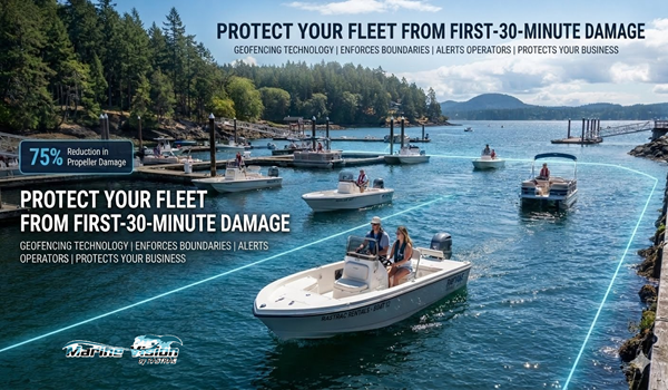
Absolutely. Geofences configured around shallow seagrass beds or coral formations trigger alerts before propellers contact fragile ecosystems. Rastrac documented a 75% reduction in propeller damage during the first season after implementing geofencing on a rental fleet. The combination of real-time alerts and deterrent effect dramatically reduces both accidental groundings and intentional off-channel exploration.
Will eco-geofencing reduce our environmental compliance insurance costs?
Most marine liability insurance carriers recognize GPS tracking as a risk mitigation tool. Documented compliance monitoring typically qualifies fleets for 5-15% premium discounts. Additionally, the ability to disprove false violation claims with historical data reduces costly legal defense expenses and protects your insurability when incidents do occur near your operating area.
The conflict between commercial marine operations and environmental protection is a false choice. Rastrac Marine Vision proves that precise compliance monitoring strengthens your bottom line while safeguarding the ecosystems your business depends on. Custom polygon geofencing, speed-layered alerts, and bulletproof historical records transform regulatory compliance from a reactive burden into a proactive business advantage. Stop relying on faded buoys and hoping for the best. Start protecting your fleet, your reputation, and our shared marine environment with technology designed for the complexity of real-world conservation.
Request a Demo | (877) 680-1188 | sales@marinevision.com

Rastrac complements any organization-wide quality assurance program and can help their fleet become the model for operational superiority.
Rastrac helps clients make improvements in processes, organization, financials, communications, and technology. Clients that have taken advantage of Rastrac’s ability to provide solutions tailored to their business are in a wide variety of industries. Rastrac can help you find a solution, too.
We’d love to discuss how we can help you.
No hardware, no installation.
Activation fee waived for every device.
Save 20% on service for six months.
