- 12741 Research Blvd. Suite 500 Austin, TX
- sales@rastracmarinevision.com
- (877) 680-1188
You’ve built a thriving marine tourism business. Bookings are up. Your calendar shows back-to-back fishing charters, sunset cruises, jet ski rentals, and sailing experiences. Your team is busy, your guests are happy, and growth is exactly what you wanted.
Then reality hits: Which pontoon boat is returning late? Did the morning fishing charter refuel? Where’s the speedboat that should have docked ten minutes ago? Is the waverunner rental group still within the safe zone?
Growth creates opportunity, but it also creates complexity. The marine operators who scale successfully don’t just attract more customers – they build systems that provide complete visibility over their expanding operations. From the moment guests book online through a booking platform to the instant each watercraft returns to dock, connected operations depend on knowing where your fleet is, what’s happening on the water, and how to coordinate every departure smoothly.
Marine_Operations_Readiness_Checklist
When Success Creates New Problems
Every marine operator wants more bookings. More families experiencing their first sailing adventure. More anglers booking guided fishing trips. More tourists renting jet skis for the afternoon.
But increased demand exposes operational gaps that smaller operations can absorb. When you’re running three trips per day, you can probably track everything mentally. When you’re managing twelve departures across six different watercraft types, mental tracking fails.
Consider a typical growing operation: You’re running center console fishing charters, pontoon boat tours, personal watercraft rentals, and sunset catamaran cruises. Each requires different preparation. Each serves different guest expectations. Each presents unique timing challenges.
Shore staff needs to know:
Without visibility, your team operates reactively. With complete fleet awareness, they operate strategically.
Beyond Booking Systems
Booking platforms like FareHarbor excel at managing reservations, processing payments, and communicating with customers before arrival. These systems create the framework for smooth guest experiences by ensuring everyone knows what’s booked, who’s coming, and what’s expected.
But booking systems can’t tell you what’s happening on the water right now.
Marine Vision by Rastrac fills that critical gap. While FareHarbor manages the customer-facing journey from booking through check-in, GPS tracking provides the operational visibility needed to execute those bookings flawlessly.
Real-time tracking delivers immediate operational value:
This visibility transforms how your shore team operates. Instead of guessing or making phone calls, they access accurate information instantly through mobile apps or web dashboards.
The Security Layer Nobody Talks About
Here’s a sobering statistic: 67% of marine theft occurs at docks and storage facilities, not while watercraft are actively being used. Your boats, jet skis, and other recreational watercraft face their highest risk during off-hours when nobody’s watching.
Marine operators invest hundreds of thousands in fleet assets. A single bass boat can exceed $50,000. Waverunners retail for $15,000-$20,000 each. Center console fishing boats easily reach six figures. Traditional security measures – cameras, locked gates, periodic patrols – provide some deterrence but offer no recovery assistance if theft occurs.
GPS tracking changes the equation entirely:
The marine insurance industry recognizes this protection: operators using GPS tracking often qualify for reduced premiums, with some insurers offering discounts reflecting the dramatically lower theft risk. Those savings alone can offset tracking costs within 12-18 months.
Coordination Starts Before Guests Arrive
Your guests receive confirmation emails through booking systems. They know their departure time, what to bring, and where to check in. They arrive excited and prepared.
But what about your operation? Is the sailboat they’ve booked even at the dock yet? Did the previous charter return on time? Has the crew completed turnover cleaning and safety checks?
GPS tracking helps your team coordinate timing with precision. When shore staff can see exactly where each watercraft is and when it’s expected back, they can:
This operational awareness directly impacts the guest experience. Customers waiting at the dock notice when staff members seem uncertain or disorganized. They absolutely notice when departures run late without explanation.
Conversely, they respond positively when your team demonstrates confidence and control. “Your captain just passed the harbor entrance; he’ll be docking in about eight minutes” sounds dramatically better than “He should be here soon.”
Real-Time Adjustments for Weather and Conditions
Marine conditions change quickly. Morning fog rolls in. Afternoon thunderstorms develop. Wind picks up unexpectedly.
GPS tracking lets you locate every watercraft immediately and communicate necessary adjustments. If weather turns threatening, you know exactly which pontoon boats need to return early, which fishing charters are furthest offshore, and which jet ski rentals are still out.
This visibility supports several critical safety functions:
Safety-conscious operators recognize that GPS tracking represents more than convenience, it’s a fundamental risk management tool supporting duty of care obligations.
Simple Integration, Powerful Results
The best operational technology doesn’t create new complexity. It eliminates existing friction.
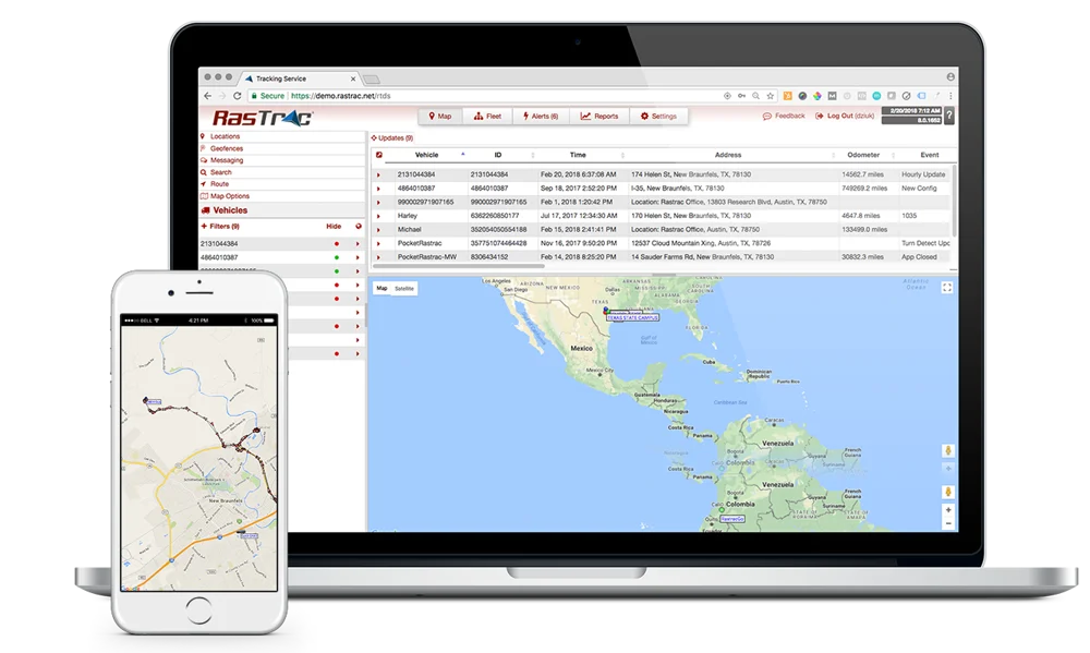
Marine Vision by Rastrac integrates seamlessly with your existing workflows. Your captains and rental customers don’t need training or special equipment. Small GPS units install discreetly on each watercraft. Shore staff access tracking through intuitive mobile apps or web dashboards requiring minimal learning curve.
Key capabilities supporting daily operations include:
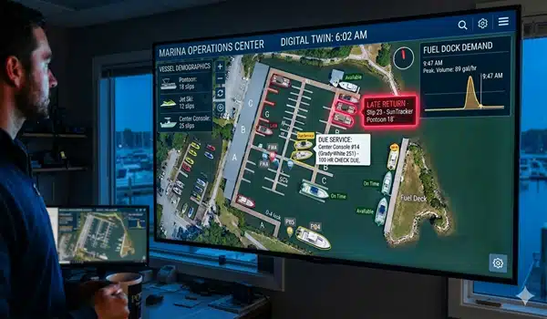
Live Fleet View: See all watercraft on a single map interface with status indicators showing which are active, which are docked, and which require attention.
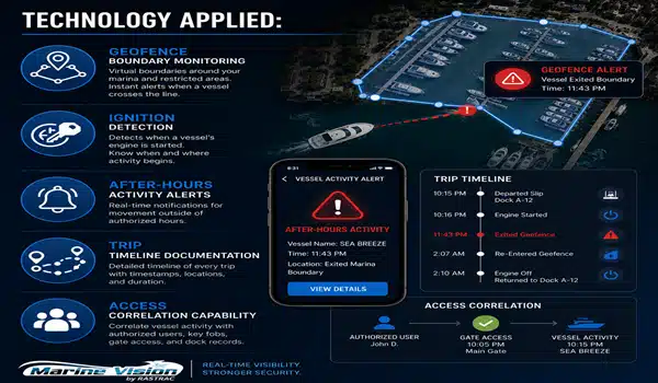
Geofencing: Create virtual boundaries around approved operating areas. Receive instant alerts when jet skis, waverunners, or rental boats cross established perimeters.
Route History: Review complete trip data including departure times, routes taken, speeds achieved and return timing. Useful for resolving guest questions, analyzing operational efficiency, and supporting any necessary incident investigation.
Usage-Based Maintenance: Track actual operating hours for each boat, triggering service reminders based on real usage rather than calendar estimates. This precision reduces unnecessary maintenance while preventing overdue service that could cause breakdowns.
Multi-Location Support: Operators managing watercraft across multiple marinas or launch points monitor everything through unified dashboards without switching between systems.
Complementing Your Booking Platform
Marine operators already use specialized software for different business functions. Booking systems such as FareHarbor manages bookings, payments, and customer communication. Accounting software tracks finances. Scheduling tools coordinate staff.
GPS tracking integrates into this ecosystem without creating silos or duplicate work. The booking system tells you what’s scheduled. The tracking system confirms what’s actually happening.
This combination creates powerful operational synergy. When a family books a pontoon boat rental, your confirmation process already knows that watercraft’s current location and availability. When their departure time approaches, your dock staff verifies the boat’s position and estimated arrival. When they head out, geofencing ensures they stay within designated rental areas. When they return, usage data automatically logs operating hours for maintenance tracking.
Each system does what it does best, and operators gain complete visibility across the entire guest journey.
Stronger Operations Create Better Reviews
Guests rarely mention operational systems in their reviews. They don’t write “The GPS tracking was excellent!” or “Really appreciated their booking software!”
But they absolutely notice the results those systems enable.
They notice when check-in feels organized and efficient. They notice when staff members provide confident answers about timing and availability. They notice when departures run smoothly without confusion or delays. They notice when everything just works.
Those operational details shape the overall experience guests remember and review:
Connected operations – combining customer-facing booking systems with behind-the-scenes fleet visibility – create the consistency that drives five-star reviews. Guests reward operators who make marine experiences feel effortless, even when significant coordination happens invisibly behind the scenes.
Growing Without Growing Pains
Adding more watercraft shouldn’t make your operation exponentially harder to manage. The right technology helps you scale efficiently:
From 3 boats to 10 boats: Manual tracking still works with three watercraft. Ten requires systematic visibility.
From 1 location to 3 locations: Multi-dock operations need centralized monitoring across distributed assets.
From seasonal to year-round: Extended operating seasons increase security concerns during off-peak periods.
From guided tours to rentals: Self-service rentals demand different monitoring than captain-led experiences.
Marine Vision by Rastrac scales naturally across all these growth scenarios. The system that tracks three fishing charters handles thirty jet skis with identical ease. Operators report that GPS tracking removed the administrative ceiling that previously limited growth, allowing them to expand fleet size without proportionally expanding management complexity.
How does GPS tracking work with existing booking systems?
GPS tracking complements reservation systems by providing operational visibility that booking platforms don’t offer. Booking software manages customer reservations, payments, and communication before guests arrive. Marine Vision by Rastrac monitors what happens on the water after they depart. Together, these systems create complete visibility from initial booking through safe return. The booking system schedules the experience; the tracking system confirms it’s proceeding as planned.
What happens if watercraft enter restricted areas or leave designated zones?
Geofencing creates virtual boundaries around approved operating zones. When any tracked boat, jet ski, or personal watercraft crosses these boundaries, the system immediately sends alerts to designated staff members via text message and mobile app notifications. This real-time awareness lets you contact the operator quickly, whether that’s a captain who strayed off-course or a jet ski rental customer who needs guidance back to permitted areas. Response time matters – instant alerts enable instant communication.
Do GPS systems require internet connectivity on the water?
Modern marine GPS tracking uses cellular networks or satellite to transmit location data, not internet connectivity on the watercraft itself. Small GPS units installed on each boat, pontoon, or waverunner communicate with cellular towers, sending position updates to cloud-based systems that shore staff access via internet-connected devices. This architecture means captains and rental customers need zero equipment, zero training, and zero technology interaction – tracking happens completely in the background while your team gains full visibility.
How quickly does GPS tracking typically pay for itself?
Most marine operators see return on investment within 12-24 months through multiple channels. Insurance premium reductions average 5-15% for GPS-equipped fleets, often covering 30-50% of tracking costs immediately. Recovered stolen watercraft (remember, 67% of marine theft happens at docks) can justify years of tracking expenses with a single incident. Operational efficiency gains – reduced staff time coordinating departures, fewer phone calls tracking locations, faster response to maintenance needs – deliver ongoing monthly savings. Rastrac’s 32-year track record reflects proven ROI across thousands of operator installations.
Can GPS tracking help with maintenance scheduling?
Absolutely. Traditional maintenance scheduling uses calendar intervals, service every 90 days or every season. GPS tracking enables usage-based maintenance, service after actual operating hours. A pontoon boat running four tours daily needs more frequent service than a sailboat operating weekends only. GPS systems track precise engine hours for each watercraft, triggering service reminders based on real usage patterns rather than guesswork. This precision prevents both under-maintenance (leading to breakdowns) and over-maintenance (wasting money on unnecessary service). Operators report 30% faster identification of developing issues through abnormal usage patterns that GPS data reveals before failures occur.
Growth shouldn’t make marine operations harder. Connected systems – combining FareHarbor’s booking excellence with Marine Vision’s fleet tracking – give you complete visibility from reservation through safe return.
Your guests experience smooth departures and organized operations. Your team gains confidence through real-time information. Your assets stay protected 24/7. Your business scales efficiently without operational chaos.
Marine Vision by Rastrac has supported marine operators for over 30 years, providing GPS tracking solutions designed specifically for the unique demands of watercraft management. From single-boat operations to large commercial fleets, operators trust Rastrac to deliver the visibility that makes every departure smoother and every operation more professional.
Request a Demo | (877) 680-1188 | sales@rastracmarinevision.com
Rastrac complements any organization-wide quality assurance program and can help their fleet become the model for operational superiority.
Rastrac helps clients make improvements in processes, organization, financials, communications, and technology. Clients that have taken advantage of Rastrac’s ability to provide solutions tailored to their business are in a wide variety of industries. Rastrac can help you find a solution, too.
We’d love to discuss how we can help you.

No hardware, no installation.
Activation fee waived for every device.
Save 20% on service for six months.
